


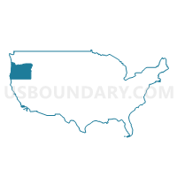
Columbia, Lincoln, Clatsop & Tillamook Counties PUMA, Oregon
About
Outline

Summary
| Unique Area Identifier | 193816 |
| Name | Columbia, Lincoln, Clatsop & Tillamook Counties PUMA |
| State | Oregon |
| Area (square miles) | 4,299.26 |
| Land Area (square miles) | 3,568.75 |
| Water Area (square miles) | 730.51 |
| % of Land Area | 83.01 |
| % of Water Area | 16.99 |
| Latitude of the Internal Point | 45.42371000 |
| Longtitude of the Internal Point | -123.66680800 |
Maps

Graphs
Select a template below for downloading or customizing gragh for Columbia, Lincoln, Clatsop & Tillamook Counties PUMA, Oregon


Neighbors
Neighoring Public Use Microdata Area (by Name) Neighboring Public Use Microdata Area on the Map
- Clark County (North)--Battle Ground City & Orchards PUMA, WA
- Clark County (Southwest)--Vancouver City (West & Central) PUMA, WA
- Cowlitz, Pacific & Wahkiakum Counties PUMA, WA
- Lane County (Outside Eugene & Springfield Cities) PUMA, OR
- Linn & Benton Counties PUMA, OR
- Portland City (Northwest & Southwest) PUMA, OR
- Washington County (West)--Forest Grove, Cornelius Cities, Bethany & Oak Hills PUMA, OR
- Yamhill & Polk Counties PUMA, OR
Top 10 Neighboring County (by Population) Neighboring County on the Map
- Multnomah County, OR (735,334)
- Washington County, OR (529,710)
- Clark County, WA (425,363)
- Lane County, OR (351,715)
- Cowlitz County, WA (102,410)
- Yamhill County, OR (99,193)
- Benton County, OR (85,579)
- Polk County, OR (75,403)
- Columbia County, OR (49,351)
- Lincoln County, OR (46,034)
Top 10 Neighboring County Subdivision (by Population) Neighboring County Subdivision on the Map
- Vancouver CCD, Clark County, WA (219,580)
- Longview-Kelso CCD, Cowlitz County, WA (63,510)
- Astoria CCD, Clatsop County, OR (24,939)
- St. Helens CCD, Columbia County, OR (23,425)
- Castle Rock CCD, Cowlitz County, WA (14,789)
- Newport CCD, Lincoln County, OR (12,375)
- Florence CCD, Lane County, OR (12,333)
- Lincoln City CCD, Lincoln County, OR (12,319)
- Tillamook CCD, Tillamook County, OR (11,950)
- Sheridan CCD, Yamhill County, OR (11,314)
Top 10 Neighboring Place (by Population) Neighboring Place on the Map
- St. Helens city, OR (12,883)
- Newport city, OR (9,989)
- Astoria city, OR (9,477)
- Lincoln City city, OR (7,930)
- Scappoose city, OR (6,592)
- Seaside city, OR (6,457)
- Warrenton city, OR (4,989)
- Tillamook city, OR (4,935)
- Toledo city, OR (3,465)
- Vernonia city, OR (2,151)
Top 10 Neighboring Unified School District (by Population) Neighboring Unified School District on the Map
- Vancouver Public Schools, WA (142,811)
- Hillsboro School District 1J, OR (125,462)
- Lincoln County School District, OR (46,192)
- Longview Public Schools, WA (45,370)
- Forest Grove School District 15, OR (34,131)
- Kelso School District, WA (28,482)
- St. Helens School District 502, OR (20,637)
- Dallas School District 2, OR (20,376)
- Scappoose School District 1J, OR (14,486)
- Ridgefield School District, WA (13,923)
Top 10 Neighboring State Legislative District Lower Chamber (by Population) Neighboring State Legislative District Lower Chamber on the Map
- State House District 18, WA (160,083)
- State House District 49, WA (134,779)
- State House District 19, WA (126,904)
- State House District 33, OR (79,509)
- State House District 24, OR (66,002)
- State House District 31, OR (62,690)
- State House District 23, OR (62,427)
- State House District 32, OR (60,293)
- State House District 10, OR (58,977)
Top 10 Neighboring State Legislative District Upper Chamber (by Population) Neighboring State Legislative District Upper Chamber on the Map
- State Senate District 18, WA (160,083)
- State Senate District 17, OR (145,013)
- State Senate District 49, WA (134,779)
- State Senate District 12, OR (128,429)
- State Senate District 19, WA (126,904)
- State Senate District 16, OR (122,983)
- State Senate District 5, OR (117,755)
Top 10 Neighboring 111th Congressional District (by Population) Neighboring 111th Congressional District on the Map
- Congressional District 1, OR (802,570)
- Congressional District 3, WA (779,348)
- Congressional District 3, OR (762,155)
- Congressional District 5, OR (757,128)
- Congressional District 4, OR (739,234)
Top 10 Neighboring Census Tract (by Population) Neighboring Census Tract on the Map
- Census Tract 15.02, Cowlitz County, WA (7,918)
- Census Tract 9604, Tillamook County, OR (7,664)
- Census Tract 304, Yamhill County, OR (7,603)
- Census Tract 9708, Columbia County, OR (6,851)
- Census Tract 16, Cowlitz County, WA (6,330)
- Census Tract 9705, Columbia County, OR (6,287)
- Census Tract 403.02, Clark County, WA (6,256)
- Census Tract 305.01, Yamhill County, OR (6,249)
- Census Tract 9702, Columbia County, OR (6,154)
- Census Tract 9706, Columbia County, OR (6,118)
Top 10 Neighboring 5-Digit ZIP Code Tabulation Area (by Population) Neighboring 5-Digit ZIP Code Tabulation Area on the Map
- 98632, WA (49,205)
- 97103, OR (16,859)
- 97051, OR (15,957)
- 98642, WA (15,696)
- 97141, OR (13,140)
- 98674, WA (12,029)
- 98660, WA (11,858)
- 97056, OR (11,497)
- 97365, OR (10,744)
- 97138, OR (10,021)